How Mapdo Works
Discover how our dashboard works and choose whether to manage everything yourself or let us handle it completely.
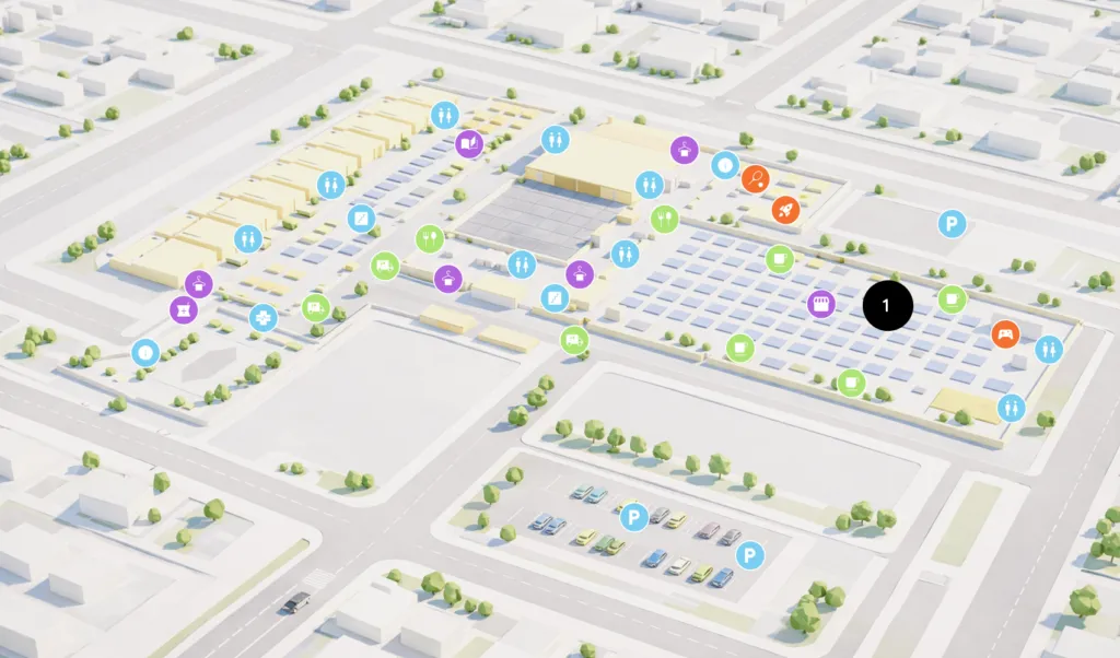
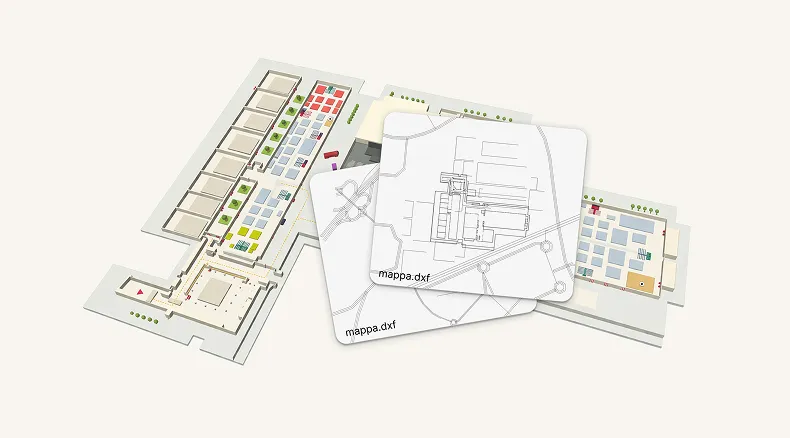
Starting from your technical plan, your DXF file is the base for building the 3D map. It allows you to decide how to organize spaces and points of interest clearly and functionally.
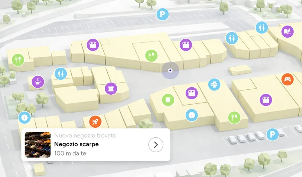
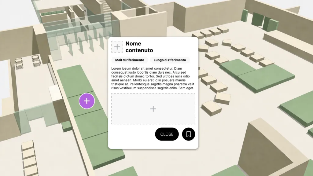
Add descriptions, images, and useful information to make navigation richer, more understandable, and more engaging.
Choose self-management or rely on us to handle the information to be included in the 3D map.

Take your map online in a few steps and keep it always aligned with content, spaces, and real-world needs.

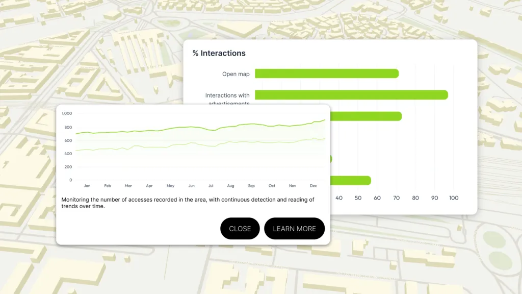
See how users interact with the map and use this information to improve content, routes, and the overall experience.
Starting from your technical plan (DXF file), we transform it into a complete and functional 3D map. We organize spaces and points of interest clearly, so you can view the result directly from your admin account without any intervention.
No input required from you: our team adds descriptions, images, and useful information for each point on the map.
Management is fully handled by us. We keep the map updated, add new content, and adapt everything to your workflow, so you can focus on data without worrying about data entry.
Alternatively, you can update the content yourself using your account.
Publishing and updating the map is no longer a problem: we take care of every step, ensuring content, spaces, and information are always aligned with reality.
See how users interact with the map directly from your admin account. We can also provide periodic reports, so you can make data-driven decisions without having to process the data yourself.
From technical plan to real-time updatable 3D map accessible from any device. Simplify flow management, make brands and services visible, and create new engagement opportunities.